

S.O.Viz_v0.9
macOS native app
Download app (39.5MB):
SOViz_.zip
Desktop only. Windows build TBD. Last tested on macOS
10.12 (Sierra) 19/12/2017
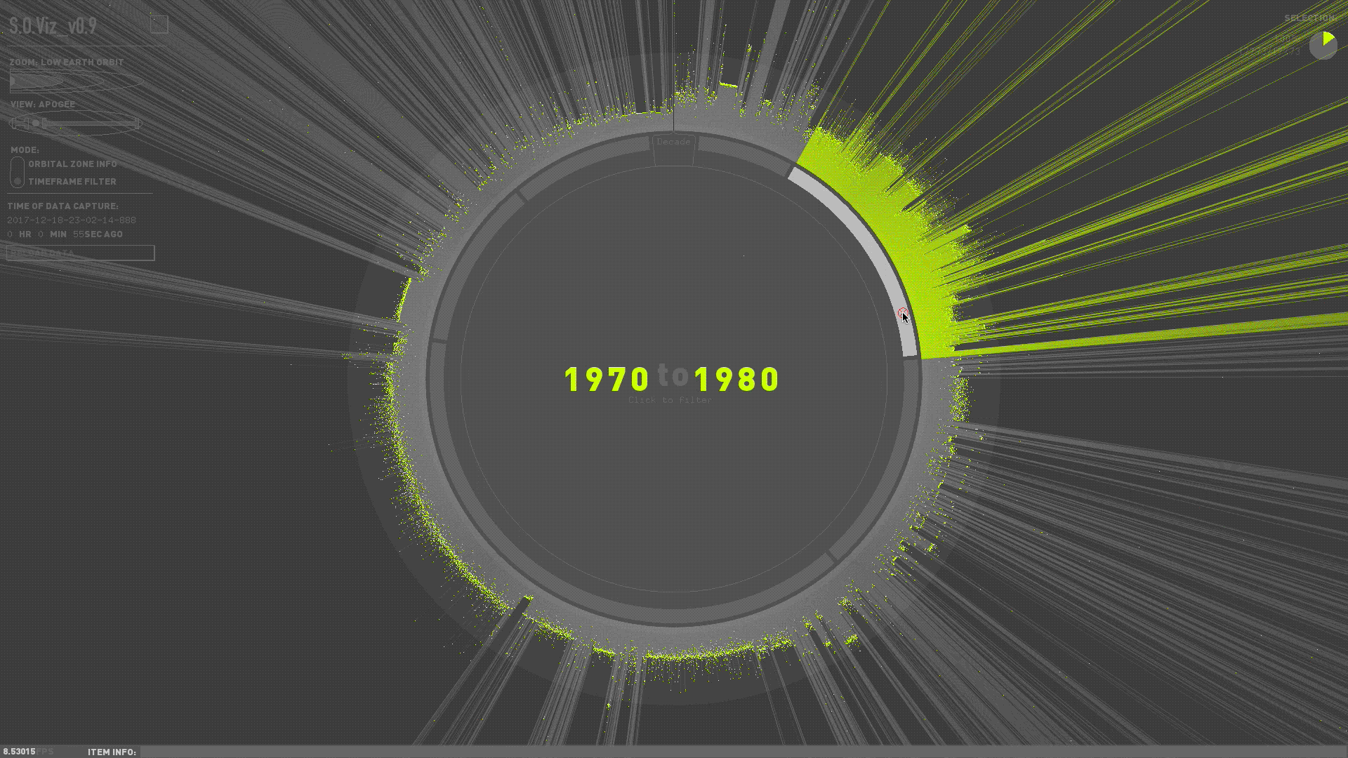
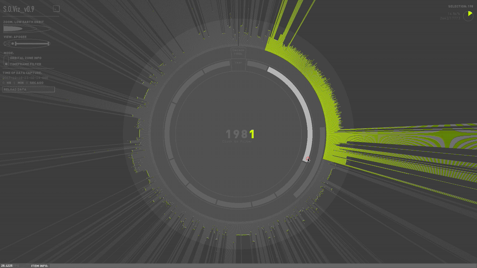
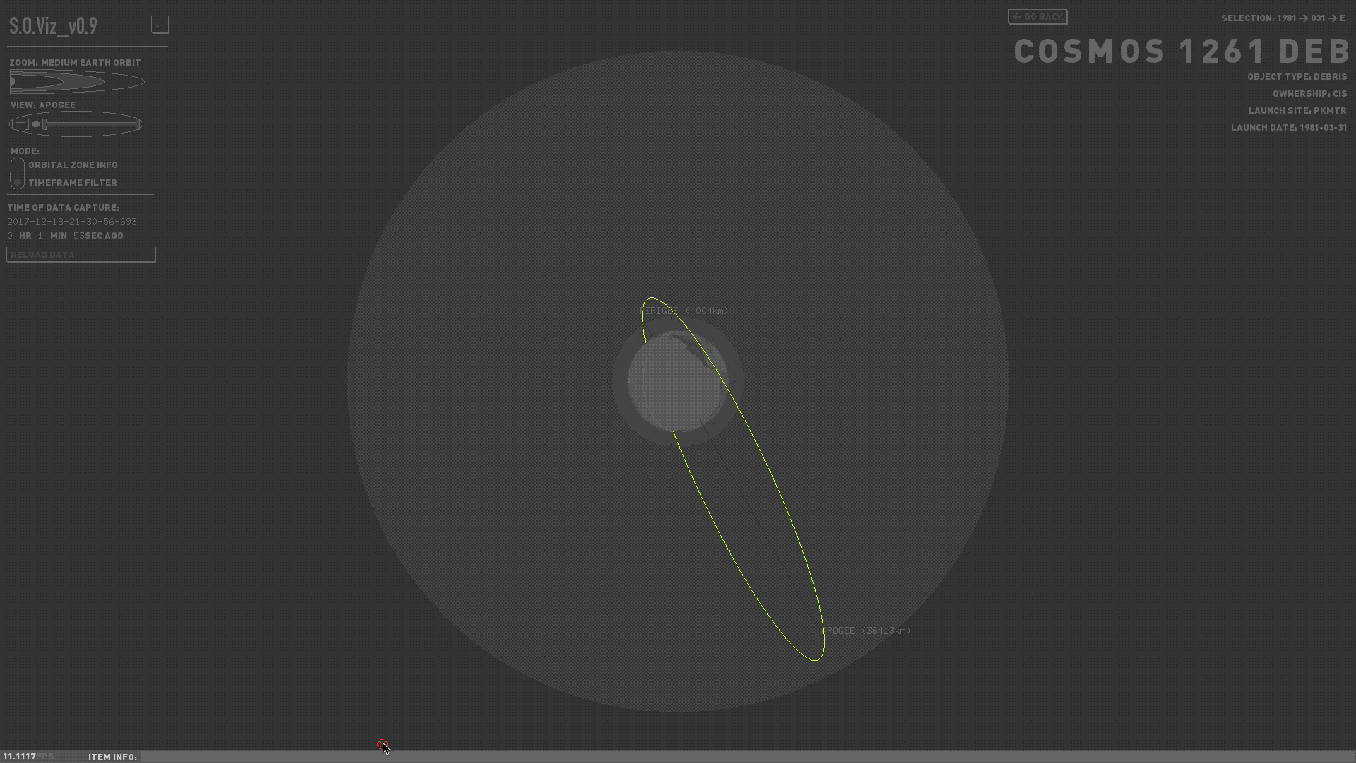
Satellite Orbital Visualization Interface (S.O.Viz_v0.9) is an interactive visualization of Earth
orbital data aggregated and made publicly available by the North American Aerospace Defense Command
(NORAD). The visual includes every satellite (loosely defined as any orbiting man-made object larger
than a softball) launched since Sputnik in 1958. It enables exploration of each satellite's latest
orbital geometry (apogee, perigee, inclination), launch date, and other functional information.
There are already many existing satellite tracking and visualization tools out there (see The Heavens
Above, Google Earth's satellite
visualization plug-in, or N2YO.) S.O.Viz_v0.9 is an attempt to visualize the data in a way
that is akin to these tools – it is both interactive and "living" (what's seen here is what is in the
sky more-or-less right now), but it also attempts to retain the graphical qualities of an infographic by
representing the data as somewhat of an abstraction that highlights intresting comparisons between its
various parts. S.O.Viz_v0.9 is a study of how these two different approaches to data visualization may
be combined; the former acting as a scientific tool for objective understanding, the other being a mode
of mediated expression.
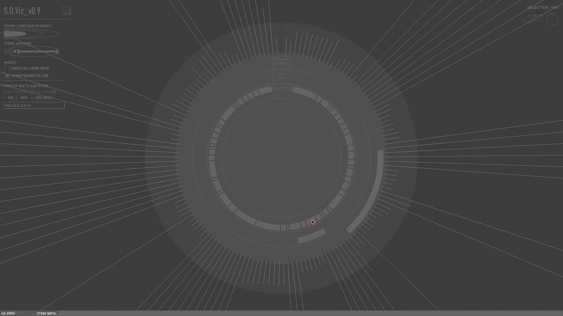
The user launches the application and is introduced to the interface while waiting for the application to fetch and allocate the satellite data. Once allocated, the data is drawn and the user begins with a macro view of dataset at High Earth Orbit. The user can zoom to other orbital zones (Medium and Low Earth Orbits) for more detailed views. At Low Earth Orbit, the user can filter the dataset by decade, then subsequently by a year within the chosen decade. Here, the details of each individual satellite can be viewed.
Built with openFrameworks, utilizing the ofxUI, ofxTween, and ofxJSON addons. The data is pulled via the Space Track REST API and written to a JSON file. The latest dataset is pulled each time the application is launched. When the download is finished, the app then culls the file and stores object names, object types (payload, rocket body, or debris), apogees, perigees, launch dates, inclinations, and periods into application memory where they are accessed throughout the duration of the app's runtime.